Tag: tropical cyclones

  • When Is Hurricane Season in 2026?

    When Is Hurricane Season in 2026?

    Hurricane season doesn’t start on the same day everywhere in 2026. You’ll see the Atlantic run Jun 1–Nov 30, peaking early September; the Eastern Pacific kicks off May 15; the Central Pacific mirrors the Atlantic; the Western North Pacific hums almost year‑round; south, it’s roughly Nov–Apr. So what do you actually do with that? I used to shrug, then scramble. You prioritize timing, supplies, and insurance—I’ll show you how, and when it really counts.

    Official 2026 Hurricane Season Dates by Basin

    basin specific hurricane season dates

    To anchor your planning, circle the windows that matter: in 2026, the Atlantic runs June 1 to November 30; the Eastern Pacific opens earlier, May 15 to November 30; the Central Pacific mirrors the Atlantic, June 1 to November 30. These Basin Calendars set your baseline so you can book trips, prep gear, and still chase the wide-open days you love. I’ve blown this before—booked boldly, then scrambled—so I’m nudging you.

    Beyond the Americas, remember Regional Exceptions. The Western North Pacific doesn’t shut down; it’s practically year-round with busier stretches, so you plan with flexible margins. Around Australia and the South Pacific, expect a formal season from November 1 to April 30, while the Southwest Indian favors November to April. The North Indian Ocean stirs April through December, with quieter pockets. Keep the dates handy, keep your choices free, and build a plan that lets you move.

    Peak Activity: When Storms Are Most Likely

    september tenth atlantic peak

    In the heart of the season, storms stack up fast—so you plan for the peaks, not just the dates. You watch the monthly peaks like mile markers: in the Atlantic, activity ramps in August, crests around September 10, and stays fierce into early October. The Eastern Pacific swells from late June through September, with a late-summer crest. The Central Pacific follows suit, quieter, but spiky. The Western Pacific? It never sleeps, but September and October hit hardest.

    What Early Outlooks May Say for 2026

    atlantic ssts enso shear

    Although the headlines will shout, you’ll want the quiet details first: early outlooks for 2026 will zero in on sea-surface temperatures across the Atlantic’s Main Development Region, any flip in ENSO (El Niño easing, La Niña lurking), and the tug-of-war between wind shear and moisture. You watch for warm pools stretching west, for Saharan dust pulses, for shear that drops just when waves roll off Africa. That’s the story under the noise, and you deserve it.

    Model predictions will sketch ranges—storms, hurricanes, majors—and yes, they’ll wobble. Seasonal analogs will offer memory: years with similar SSTs, similar ENSO swings, similar shear profiles. Do they guarantee anything? No. Do they give you a lane to think in, to move in, to breathe in? I’ll admit, I check them, curious. Read them, question them. Favor patterns over hype, signals over spikes, trend over headline. Hold your options open; hold your ground.

    Preparedness Steps to Take Now

    map routes secure home practice

    Because storms don’t wait, you shouldn’t either. Start now with simple moves that protect your freedom to choose, to leave, to return. Map your Evacuation Routes from home, work, and school; drive them at dusk, note flood-prone dips, name a meetup spot. Strengthen what you own: focus on Home Fortification, not perfection—anchor patio furniture, seal gaps, trim limbs away from eaves. And practice, because practice builds calm.

    • Walk your block, spot loose signs and clogged drains, then report or clear what you safely can.
    • Photograph each room, back up files and contacts, and share access with a trusted buddy.
    • Run a family drill: shoes by the door, car facing out, pets crated, doors locked.

    Set up a neighbor check-in chain; freedom grows when we’ve got each other’s backs. I get it—I put this off too, then felt lighter the minute I moved. You’ve got this.

    Insurance, Supplies, and Timeline to Get Ready

    insurance supplies timely preparation

    Before the winds spool up, you’ll lock down three things: insurance, supplies, and a simple timeline.

    Before winds spool up, lock down three things: insurance, supplies, a simple timeline.

    Call your agent, raise questions, and confirm coverage for wind, flood, and temporary housing.

    Document valuables now, store photos in the cloud, and learn the claims process before chaos hits.

    Build a two-week kit: water, shelf-stable food, meds, pet needs, chargers, cash, and copies.

    Practice supply rotation so nothing goes stale, and keep gas tanks half full.

    Set a timeline by month: May tunes your kit, June trims trees, July updates contacts, August drills.

    When watches post, you secure shutters, elevate gear, back up data, then rest.

    You’re not overreacting; you’re claiming space, time, and choice.

    I still get nervous, but action steadies the hands and widens your freedom.

    Move early, move lightly, move together, because your life is the plan, and the plan protects it.

    You’ve got this, and I’m here.

  • When Is Hurricane Season 2026?

    When Is Hurricane Season 2026?

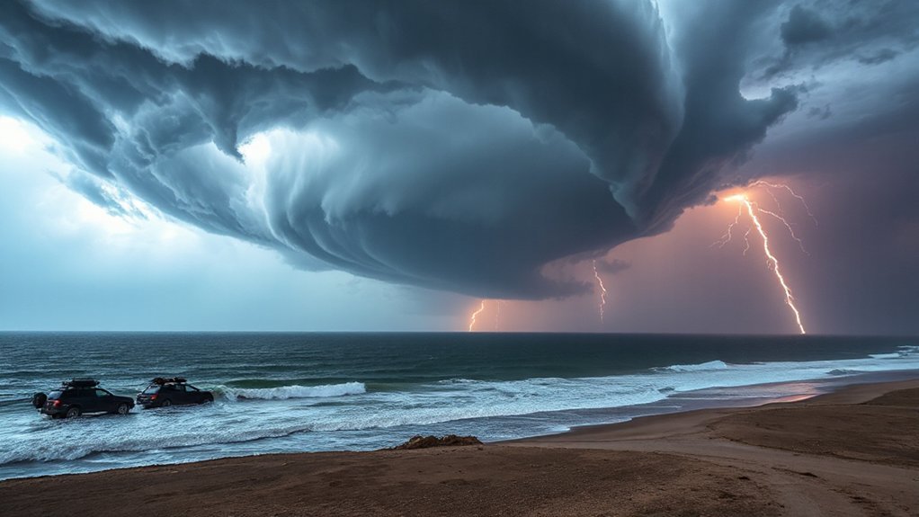
    When we ask about hurricane season 2026, it’s natural to want clear answers, but the truth is, it’s shaped by many factors—ocean temperatures, atmospheric patterns, even volcanic aerosols. Usually, the Atlantic season runs from June 1 to November 30, with peak activity in September, though things can shift. So, as we plan ahead, staying informed with official updates from NOAA and readying our plans early is more important than ever—because knowing when storms could strike helps us stay safe.

    Typical Dates for the Atlantic Hurricane Season

    dates define hurricane preparedness

    Why these dates?

    Warm ocean waters and atmospheric conditions create the perfect storm environment, quite literally.

    So, when planning for hurricane season 2026, remember these dates aren’t just dates—they’re guardrails.

    Mark your calendars, stay alert, and be ready for whatever Mother Nature might throw our way.

    Expected Timing for the Pacific Basin

    pacific hurricane season may november

    In the Pacific Basin, hurricane season usually kicks off in late spring and peaks through the late summer and early fall—think May through November.

    So, when planning operational calendars or shipping schedules, it’s vital to keep that timeframe in mind.

    Most Pacific storms form between June and October, with the peak around August.

    Shipping companies, cargo handlers, and even coastal communities start paying close attention as early as May, tracking weather patterns and potential storm paths.

    Knowing when hurricanes are likely helps us adjust routes, avoid delays, and keep everyone safe.

    It’s not just about preparedness; it’s smart logistics.

    For businesses and travelers alike, understanding that window means fewer surprises and smoother operations.

    Mark your calendar, stay updated with forecasts, and plan ahead.

    Because when it comes to hurricanes, knowing the expected timing isn’t just helpful—it’s essential.

    Factors Influencing the 2026 Hurricane Season

    volcanic aerosols shipping emissions

    Several key factors will shape the 2026 hurricane season, and understanding them helps us stay prepared. One big influence is volcanic aerosols—tiny particles released during eruptions—that can cool the atmosphere temporarily, reducing hurricane activity by blocking sunlight.

    So, if a volcano erupts closer to hurricane season, it might calm things down for a bit. But, don’t forget shipping emissions—those are the pollutants ships release into the atmosphere. These emissions, especially sulfur compounds, can impact weather patterns too, possibly leading to more storm activity by affecting global temperatures and wind patterns.

    It’s like a complex chemical dance up there, and we’re still figuring out all the moves. These natural and human-made influences play a real role in how busy the season might be. Whether it’s a volcanic eruption or the steady rise of shipping emissions, understanding these factors keeps us one step ahead, ready to face whatever storms come our way.

    historical patterns guide preparedness

    Looking back at past hurricane seasons, we see clear patterns—some years peak early, others stretch into late fall, and timing often lines up with specific climate signals.

    But it’s not just about when storms hit; conditions like sea surface temperatures and atmospheric patterns play a key role, sometimes conditionally changing the game.

    Understanding these trends helps us prepare better, because history isn’t just stories; it’s a roadmap for what’s next.

    Past Season Timing

    Most hurricane seasons follow a familiar rhythm, with most storms brewing somewhere between June and September.

    But looking at past season timing, we see some surprises. Data revisions over the years, often from improved technology, change our understanding of when storms happen. Sometimes, observation gaps—those days or months when satellites or ships weren’t collecting data—hide storms from records.

    Historically, peak activity stays consistent, but the start and end dates can shift slightly. For example, some seasons officially begin in June but see early storms in May, or extend into November.

    These patterns help us predict future seasons better, though they’re never perfect. The key takeaway? Keep an eye on emerging trends—storm timing isn’t written in stone.

    Climate Influences Conditionally

    Climate isn’t just background noise for hurricanes—it volunteers as a key player, tilting the odds in our favor or against us. Aerosol interactions, for example, can cool or warm sea surfaces, affecting storm development. Particles from pollution or volcanic eruptions bounce sunlight around, changing ocean and air temperatures.

    Then there’s stratospheric variability, which influences weather patterns and jet streams, often making seasons more unpredictable. When these factors shift, they can either ramp up or suppress hurricane activity.

    This isn’t just guesswork; scientists track these subtle changes to better predict when storms might strike. It’s a complex dance where tiny particles and upper atmosphere quirks can mean the difference between a quiet season and a busy one. Staying aware helps us prepare, even when the climate isn’t playing by the usual rules.

    How Climate Change May Alter Season Duration

    increasingly prolonged hurricane seasons

    As our planet warms, there’s a good chance hurricane seasons won’t stick to the same timetable they’re used to. Scientists suggest that with rising temperatures, storm activity might start earlier or linger later, stretching the season longer.

    Why? Because warmer oceans fuel storms, giving them more energy and a longer lifespan. This change could mean insurers need to rethink how they structure coverage—more extended periods mean more risk, more claims.

    It may also disrupt ecosystems, as intense storms hit at unpredictable times, affecting wildlife, reefs, and coastal habitats. This isn’t just about weather; it impacts your safety, your property, and your wallet.

    So, what can we do? Stay informed, adapt insurance plans proactively, and support efforts to reduce climate change. The longer seasons won’t just be inconvenient—they’ll reshape our approach to preparedness and resilience.

    We’re in this together, making adjustments for an uncertain stormy future.

    Preparing for the Peak Months

    As we approach the peak months of hurricane season, it’s vital to know when storms are most likely to strike and how to stay ahead of them.

    We need to focus on essential steps—checking supplies, securing our homes, and staying informed—because preparation isn’t just smart; it’s lifesaving.

    And don’t forget, reviewing your local emergency plans now makes sure everyone in your family knows exactly what to do when seconds count.

    Timing of Peak Months

    While it might seem early, the peak months of hurricane season are already on the horizon, usually hitting their stride from August through October. That’s when storms tend to cluster, creating what’s called event clustering—multiple hurricanes in a short window.

    Peak predictability is higher during these months because weather patterns become more consistent, making storms more likely. But don’t get complacent—storms can pop up anytime from June through November.

    Still, history shows us these months are the busiest, with September often hitting the highest peak. Knowing this timing helps us prepare better, plan evacuations, and stock up early. So, now’s the time to stay alert, keep an eye on forecasts, and brace ourselves—hurricane season marches on, whether we’re ready or not.

    Essential Preparation Steps

    Getting ready for peak hurricane months isn’t something we can check off in a day. It takes steady, focused effort.

    First, consider home reinforcement—think storm shutters, securing loose items outside, and trimming dead branches that could become projectiles. These small steps make a big difference.

    Next, review your insurance. Do you have enough coverage? Understand your policy, especially about flood damage, which isn’t always included.

    Update your contacts and keep important documents like insurance papers in a waterproof, easy-to-reach place.

    It’s about proactive measures—don’t wait until the storm’s on the horizon. These steps aren’t just prep—they’re peace of mind.

    Because when hurricane season hits, we want to be ready, confident, and a little more in control.

    Local Emergency Plans

    Preparing for peak hurricane months means knowing exactly what to do if a storm heads our way.

    Our local emergency plan is key—it’s like our blueprint for safety.

    First, we should know shelter locations—where to go if evacuation becomes necessary.

    These are set up in schools, community centers, and designated safe zones.

    But it’s not just about where; it’s about who, too.

    Volunteer coordination plays a big role—we count on neighbors and groups to help distribute supplies, check on vulnerable folks, and keep everyone informed.

    Have we discussed our plan with family? Do we’ve emergency kits ready?

    Being prepared isn’t just about weather forecasts, it’s about knowing our roles, staying organized, and supporting each other when it matters most.

    We’ve got this—together.

    Monitoring Resources and Forecast Updates

    We constantly keep an eye on the skies—that’s how we stay ahead during hurricane season. Satellite feeds are our front-line tools, providing real-time images and data from space. They show us cloud formations, storm tracks, and even movement speed, letting us spot potential trouble early.

    But that’s not all. We rely heavily on model ensembles—groups of forecast models run with slightly different variables—to predict how hurricanes might evolve. These models help us see various possible paths, giving us a clearer picture of risk areas.

    Sometimes, models disagree, so we analyze the differences carefully, understanding that no forecast is perfect. Regular updates keep us informed, whether it’s a sudden shift in a storm’s path or intensification.

    Staying tuned to official sources like NOAA guarantees that we’re always working with the latest info. It’s all about being prepared, confident, and ready to act—before hurricanes even know what’s coming.

    Conclusion

    So, as we brace for hurricane season in 2026, staying informed is key. Watch official updates, review your emergency plan, and keep supplies ready. Remember, peak activity usually hits September, but shifts happen—nature’s unpredictable that way. Prepare early, stay alert, and don’t wait until the last minute. We’re in this together—being proactive makes all the difference. Stay safe, stay smart, and keep one eye on the forecast!